Digby Trails
  • Home
  • Digby Outdoors Map
  • Challenge badges
  • TRAILS
    • Balancing Rock >
      • Wildflowers of Balancing Rock
    • Acacia Valley >
      • Lichens of AVT
      • Wildflowers of AVT
    • Van Tassel Lake >
      • Phone of the Wind
      • Lily Lake Lollygag Trail Run
    • Gulliver's Cove
    • Fundy View Trail
    • Central Grove Trail
    • Brier Island Coastal Trail
    • Storybook Trail
    • Railbed >
      • Plan - Digby Railbed Trail
  • Point Prim Lighthouse
    • Point Prim directions
    • Further hiking at Point Prim
  • Maud Lewis
    • Maud Lewis Gravesite
  • Haines Lake
  • #digbyrocks
  • Fundy Erratics hiking club
ALL TRAILS CLOSED - May 30, 2023 and until further notice
 
In accordance with Nova Scotia Government’s announcement that all activity in wooded areas is banned, all trails within the Municipality of the District of Digby are closed until further notice.
 
Please do not enter any woods or trails – this includes the railbed. This includes hiking, fishing, cycling, riding, running and ATVing.
 
We ask that you keep safety foremost in your mind.
Effective immediately and until further notice.

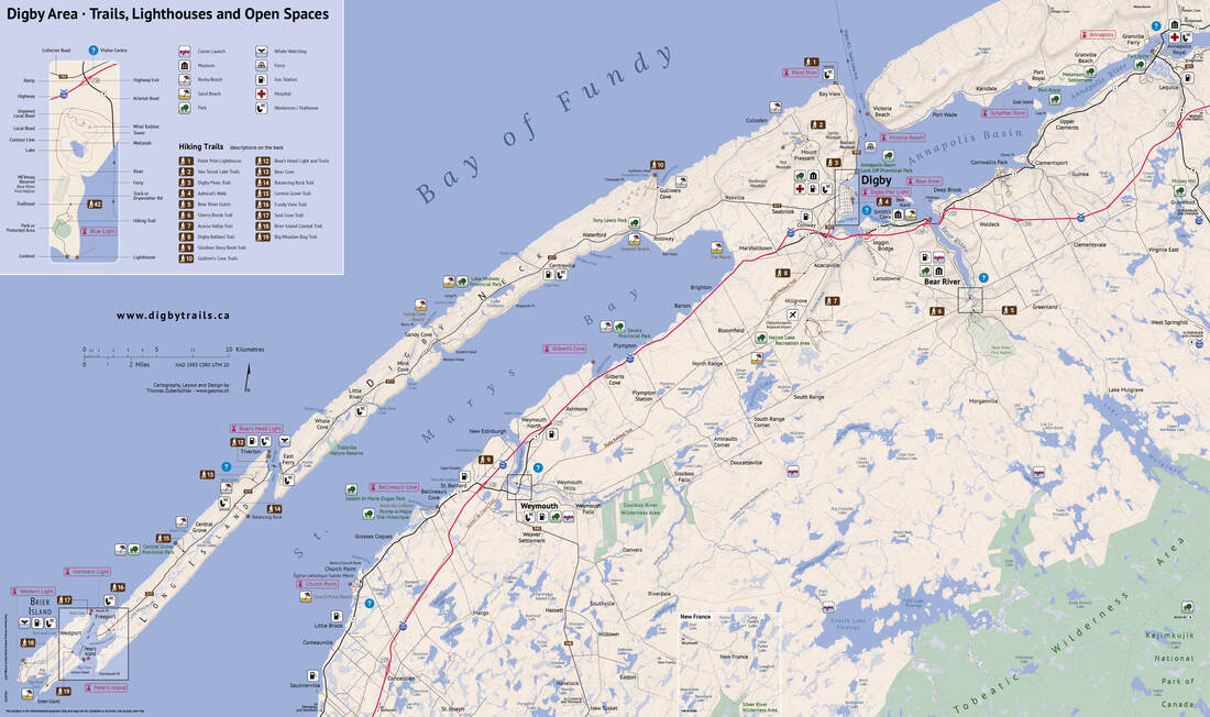
Digby Outdoors Map

To see a printable, downloadable PDF (12 MB) click the link below:
Digby Trails, Lighthouses and Open Spaces Map (PDF 12MB)     .

Click on the images below for larger JPG versions.
Picture
Picture
Picture
  • Home
  • Digby Outdoors Map
  • Challenge badges
  • TRAILS
    • Balancing Rock >
      • Wildflowers of Balancing Rock
    • Acacia Valley >
      • Lichens of AVT
      • Wildflowers of AVT
    • Van Tassel Lake >
      • Phone of the Wind
      • Lily Lake Lollygag Trail Run
    • Gulliver's Cove
    • Fundy View Trail
    • Central Grove Trail
    • Brier Island Coastal Trail
    • Storybook Trail
    • Railbed >
      • Plan - Digby Railbed Trail
  • Point Prim Lighthouse
    • Point Prim directions
    • Further hiking at Point Prim
  • Maud Lewis
    • Maud Lewis Gravesite
  • Haines Lake
  • #digbyrocks
  • Fundy Erratics hiking club