Digby Trails
  • Home
  • Digby Outdoors Map
  • Challenge badges
  • TRAILS
    • Balancing Rock >
      • Wildflowers of Balancing Rock
    • Acacia Valley >
      • Lichens of AVT
      • Wildflowers of AVT
    • Van Tassel Lake >
      • Phone of the Wind
      • Lily Lake Lollygag Trail Run
    • Gulliver's Cove
    • Fundy View Trail
    • Central Grove Trail
    • Brier Island Coastal Trail
    • Storybook Trail
    • Railbed >
      • Plan - Digby Railbed Trail
  • Point Prim Lighthouse
    • Point Prim directions
    • Further hiking at Point Prim
  • Maud Lewis
    • Maud Lewis Gravesite
  • Haines Lake
  • #digbyrocks
  • Fundy Erratics hiking club

#digbyrocks - trail news from Digby

Opening for Digby trail bridge

9/28/2018

2 Comments

 
Picture
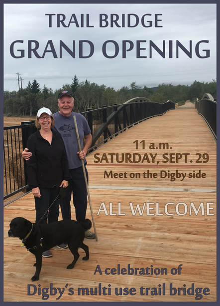
Trail enthusiasts are invited to join in a celebration of the new trail bridge over Hwy 101 near Exit 26 in Conway just outside Digby.
The grand opening is scheduled for Sept. 29 at 11 a.m. on the north side of the bridge (the Digby side).
South West Nova MP Colin Fraser, Clare Digby MLA Gordon Wilson and Warden of the Municipality of the District of Digby, Jimmy MacAlpine will cut an alder branch to mark the official opening before crossing the bridge with those in attendance.
Greg Turner, chair of the Digby Area Tourism Association is looking forward to the bridge celebration.
“We are inviting cyclists, horse riders, walkers, ATVers, all the various users of this bridge to celebrate together,” says Turner.
Please meet on the Digby side - for those driving to the bridge opening, easiest access is via a highway access road from the far end of the Flat Iron Road.
Park on the shoulder and well off the road near the electrical substation. Please take care to keep the road clear for any traffic needing access to the highway construction site. The contractor is working on Saturday and has been made aware of the ceremony.
Rubber boots are recommended as the access road is still under construction and could be muddy after all this recent rain.
The Digby County ATV Club will be hosting a BBQ afterwards with hotdogs, sausages water and pop.

DETAILED DIRECTIONS:
From Hwy 101, take Exit 26 and drive 1 km towards Digby on Hwy 303.
Turn left just past Guy Frenchies and Accesss Nova Scotia onto Flat Iron Road.
Continue about 900m to the southern end of Flat Iron Road and park on the side of the road near the electrical substation (N 44.599743, W 65.778081).
A service road on the same side of the road and just past the substation leads about 90 metres to the railbed. Turn left at the railbed and you will see the bridge just ahead.
2 Comments

    Author

    Jonathan Riley, trails and open space coordinator with the Municipality of the District of Digby

    Archives

    March 2022
    May 2021
    January 2021
    May 2020
    April 2020
    February 2020
    January 2020
    September 2019
    January 2019
    October 2018
    September 2018
    June 2018
    May 2018
    January 2018
    December 2017
    November 2017
    October 2017

    Categories

    All

    RSS Feed

Picture
  • Home
  • Digby Outdoors Map
  • Challenge badges
  • TRAILS
    • Balancing Rock >
      • Wildflowers of Balancing Rock
    • Acacia Valley >
      • Lichens of AVT
      • Wildflowers of AVT
    • Van Tassel Lake >
      • Phone of the Wind
      • Lily Lake Lollygag Trail Run
    • Gulliver's Cove
    • Fundy View Trail
    • Central Grove Trail
    • Brier Island Coastal Trail
    • Storybook Trail
    • Railbed >
      • Plan - Digby Railbed Trail
  • Point Prim Lighthouse
    • Point Prim directions
    • Further hiking at Point Prim
  • Maud Lewis
    • Maud Lewis Gravesite
  • Haines Lake
  • #digbyrocks
  • Fundy Erratics hiking club