 Fabulous Fundy flakes favour southwest Nova
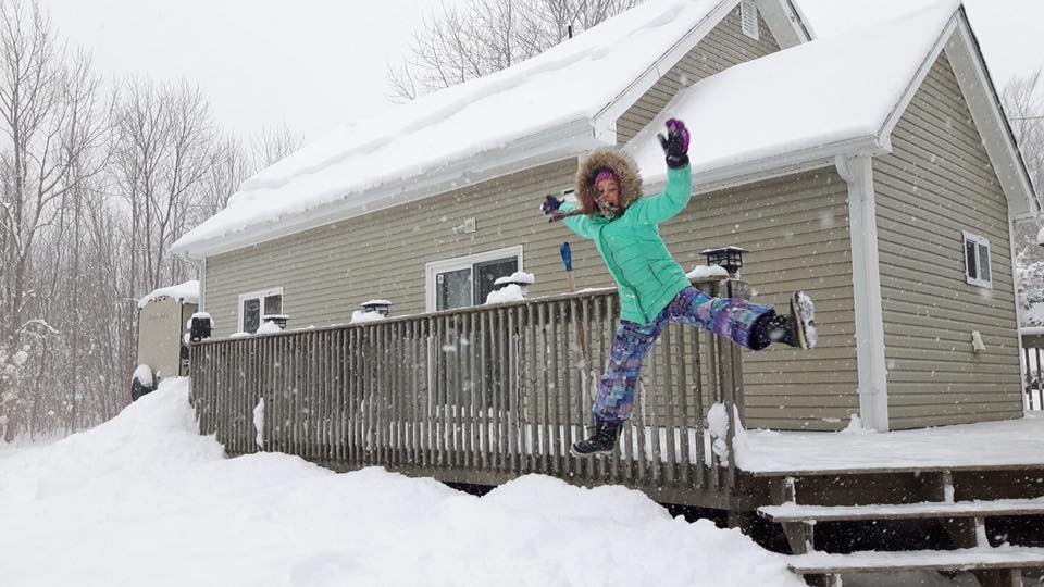
Digby is the snow capital of the province right now and aren't we lucky. Judging by the tracks at the Digby Pines golf course, the Acacia Valley Trails, at Van Tassel Lake, and on the railbed, a lot of people have been out and enjoying the wonderful wintry weather. It has been snowing in Digby for a week and the light and fluffy flurries have really piled up. The snow has been a little wispy letting skis and snowshoes sink through to the ground underneath but the last few days it has started to thicken up and get some real base to it. If you’ve never tried snowshoeing, this is a great time to borrow a pair from Digby Area Recreation and head out to the Pines to play in the snow. Snowshoeing is super easy to learn – it is just walking with extra big shoes. Snowshoeing isn’t necessarily faster than walking in boots but if you take your time, it saves you sinking to your knees or waist, and gives you a little more traction and stability. Snowshoe hikes and trails A group of people on Digby Neck have an easy hike to a winter waterfall planned for Wednesday, Jan. 3. They are meeting at 1 p.m. on the Wharf Road in Sandy Cove, parking there and then hiking to TR Falls. The route is mostly along a snow-covered gravel road with just a short scamper through the woods to the falls at the end. Other local options include the Acacia Valley Trails on Mill Road in Hillgrove. The Department of Transportation and Infrastructure Renewal keeps this gravel road well plowed but the steep section near the bottom can be slippery depending on snowfall and ice. Beginners can stick to the wide, level trail and the adventurous can roam off on the single track trails to the Hardwood Ridge, Picnic Rock, and Tupper’s Deadwater or even connect into the miles and miles of logging road on the neighbouring Crown lands. The Van Tassel Lake Trails are also a great place to snowshoe with easy walks to the lake, a rougher but beautiful loop around the lake or the demanding hike to the look off with a stunning view of the snow-covered uplands. For more information on the trails in the Municipality of the District of Digby go to digbytrails.ca. #FUNDYFLAKES As trail coordinator for the Municipality of the District of Digby, I want to share with everyone just how beautiful and fun it is here right now. I’d really appreciate it if Digby County folk could share their best fun-in-the-snow photos of sledding, skiing, snow sculptures, forts and snowmobiling. You can email me the photos at [email protected] or message me on Facebook or just post them on Facebook, Instagram or Twitter with the hashtag #fundyflakes FUNDY ERRATICS WINTER HIKES The Fundy Erratics also have a series of winter snowshoe hikes planned Jan. 20, Feb. 17 and March 24. Jan. 20 - Railbed The first hike will be relatively easy. The plan is to snowshoe 7.5 km on the railbed from Jordantown to the airport. This hike is intended to introduce people to the fun of snowshoeing on relatively even and level terrain but also to show you some of the winter beauty out there along our railbed. Feb. 17 – Acacia Valley In February we will try something a little more aerobically demanding on the Acacia Valley Trail on the Mill Road in Hillgrove. The plan is again 7 or 8 km but the terrain, while not hilly, is a uneven and wild. We’ll plan on following Aunt Sarah’s Brook by several frozen pools to Tuppers Deadwater and then over to Picnic Rock for a little bonfire. March 24 – Gulliver’s Cove And in March, we’re planning a strenuous climb to a couple of spectacular lookoffs above Gulliver’s Cove. The hike is only 5 or 6 km but parts are very steep. We’ve scheduled this one for late in the season so you have lots of time to get in snowshoe shape.
0 Comments
Leave a Reply. |
Author
Jonathan Riley, trails and open space coordinator with the Municipality of the District of Digby Archives
May 2023
Categories |
 RSS Feed